
Cairn
An existing rock marker may guide a route, but hikers should not build or alter one.
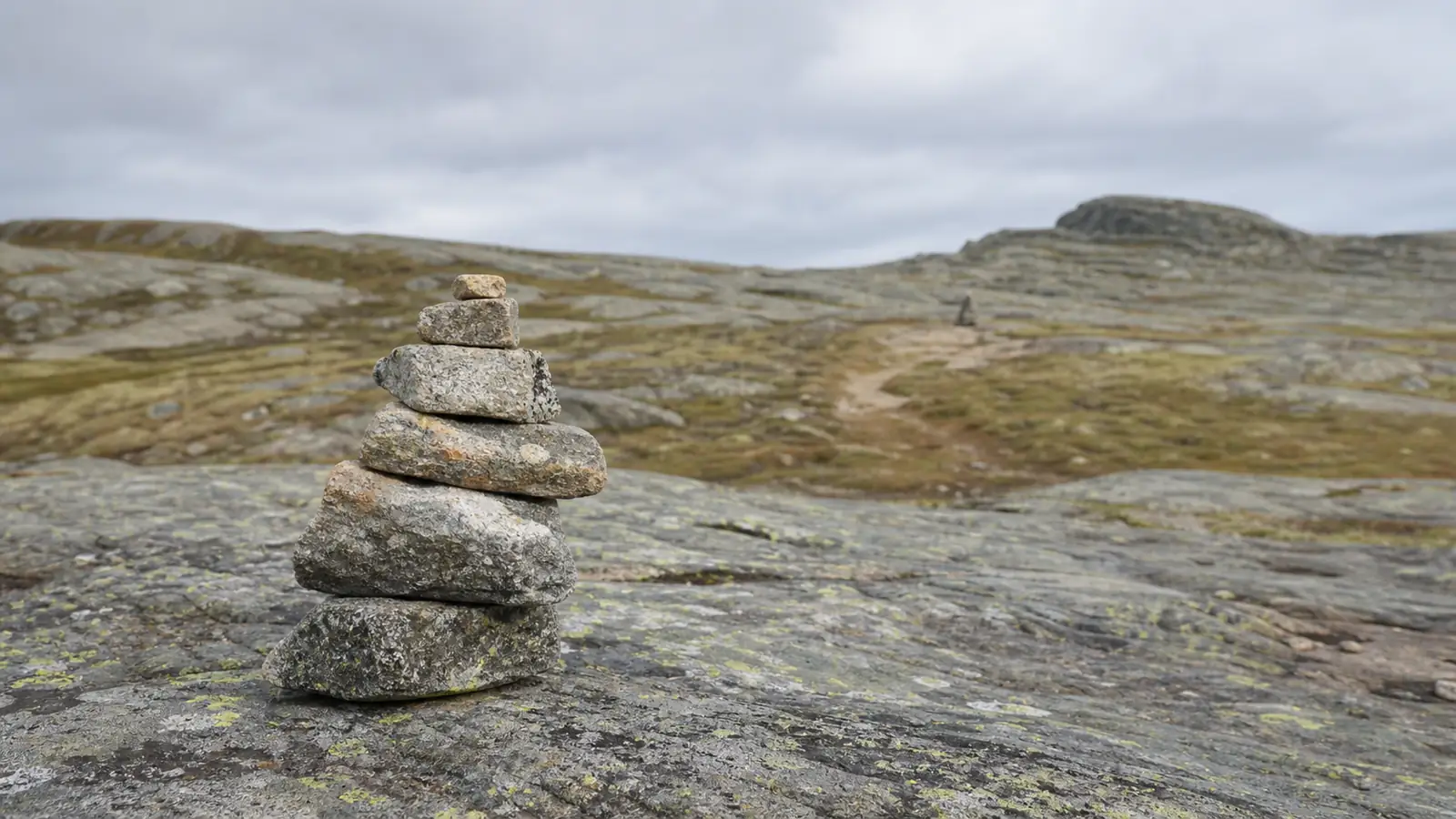
A cairn can be an official route marker on bare rock, lava, or open alpine terrain, yet an ornamental rock stack can also mislead hikers. Learn the local marking system, keep the next approved marker in sight, and leave every cairn unchanged.
What is a cairn on a trail?
A cairn is a deliberately arranged pile or structure of stones. Land managers sometimes use cairns to mark an established route where soil tread, posts, trees, or painted blazes are impractical. Bare lava, slickrock, and terrain above tree line are common examples.
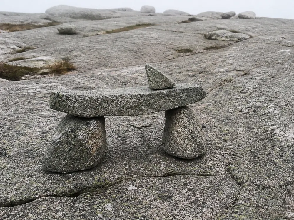
The shape is not universal. Acadia National Park maintains a distinctive Bates cairn, while other parks use smaller rock piles. Some places do not maintain cairns at all and warn visitors not to rely on random stacks.
A Bates cairn shows why shape can carry local meaning. Two base stones support a flat lintel stone, and a separate pointer stone sits on top. The pointer indicates the intended direction of travel. A conical pile may serve the same purpose somewhere else, so you cannot transfer one park's visual rules to another trail.The words rock stack, rock pile, and cairn are often used loosely in conversation. The label does not prove that staff placed or maintain the stones. Official context matters more than the nickname or shape.
| Signal | More consistent with an approved route | Reason to stop and verify |
|---|---|---|
| Official description | Says cairns mark this route | Gives a different marker system |
| Pattern | Repeated markers align with map and terrain | One isolated stack leaves the route |
| Placement | Supports travel across bare, durable ground | Pulls hikers onto plants, crust, or unstable slope |
| Condition | Structure is intact and deliberately maintained | Fresh loose stack, scattered rocks, or competing piles |
| Next point | Next marker or mapped feature is visible | No continuation can be confirmed |
Context decides whether it guides. A pile of rocks is not automatically an approved marker.
An approved cairn belongs to the land manager's route system. It is not a visitor decoration, a summit trophy, or permission to rearrange natural and cultural resources.
- Approved use
- A route marker only where the land manager says cairns guide travel
- Reliable pattern
- A repeated sequence that agrees with the official map and terrain
- Hiker action
- Follow existing markers without building, adding, moving, or dismantling stones
- Fallback
- Stop at the last confirmed point when the sequence and map stop agreeing
How can you judge an existing cairn?
Start with the official route information, then look for a consistent sequence. On a cairned route, each marker should support the mapped direction and the terrain described by the agency. A single pile leading away from that sequence deserves suspicion.
The NPS guidance for El Malpais tells hikers to keep the next cairn in sight before moving to it. That rule limits how far one doubtful marker can pull you from the last known point.
Use the sequence, not one stack, to confirm direction.
Look backward as you travel because the return view changes. A marker that stands out in one direction may blend into the skyline in the other.
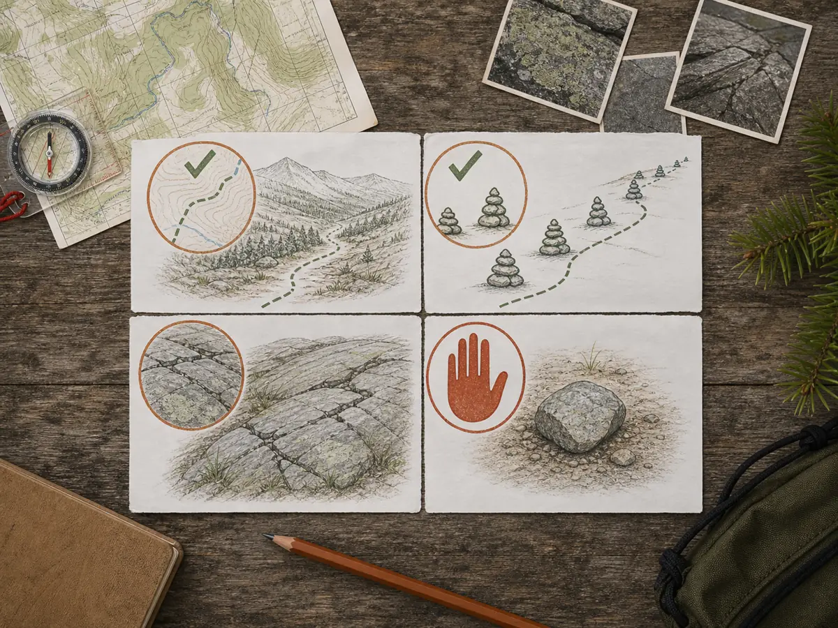
When terrain makes the route uncertain, use an independent map and the compass navigation process rather than searching for any nearby rock pile.
When can cairns become difficult to follow?
Cairns are easiest to follow when each marker is visible from the previous one and the sequence agrees with the mapped route. Distance alone does not make a marker reliable. Stone color, background rock, vegetation, and the angle of approach can hide a cairn that is nearby.
Visibility changes with conditions, so confirm the whole sequence instead of trusting one pile.
Fog, blowing snow, flat light, or darkness can remove the contrast between a marker and the ground. Snow may cover a low cairn completely. A tall drift can also make exposed rocks look like a deliberate pile when they are not part of the summer route.
Your return view can be the harder direction. Stop occasionally and photograph or study the last confirmed marker from the angle you will see on the way back. Do this while you remain on the approved route, not by walking around fragile ground to get a better view.
Visitor-built stacks create a different problem. Several convincing piles may point in competing directions, especially near overlooks, junctions, or popular stopping spots. More stacks do not create more certainty. They reduce the value of shape as evidence.
Some cross-country areas have no official markers at all. Olympic National Park warns that cairns or flagging away from established trails may have been left by visitors or researchers and may lead elsewhere. In that setting, a rock pile is a reason to check your position, not a direction command.
When weather, snow, or competing stacks break the sequence, return to the last point where the map, terrain, and marker agreed. Continuing until another pile appears can turn a small uncertainty into a long route error.
Why should hikers not build or add to cairns?
Unauthorized cairns can point later visitors away from the established route. Moving rocks also disturbs soil, fragile plants, small habitats, and cultural features. Adding stones may destabilize a carefully designed marker.
National parks repeatedly give the same practical instruction: do not build, add to, knock down, or rearrange cairns. Report a confusing marker to staff instead of deciding which pile should remain.
Leave the rocks where they are unless authorized staff direct otherwise.
Navigation
A false cairn can create a convincing path away from the mapped route.
Soil
Lifting and restacking stone exposes soil that wind and water can move.
Habitat
Rocks shelter small plants and animals that a casual stack can disturb.
History
Some cairns are maintained structures or cultural features, not loose building material.
Stability
Extra rocks can cause an approved cairn to collapse or lose its designed shape.
Do not dismantle a cairn because you think it is unofficial. A hiker may not know the manager's design, maintenance plan, or cultural context. Share the location and a photo with the agency.
The same low-impact rule belongs in practical trail etiquette guidance: use the established route and leave natural objects where you found them.
What should you do when cairns conflict or disappear?
Stop at the last point that matches the map. Competing cairns, a marker that leads onto fragile ground, or a missing continuation all reduce route confidence. Do not solve the problem by building another pile.
Compare the map, travel direction, landforms, and any official signs. Retrace known ground when it is safe. If you cannot recover the route, use your trip's lost-person and emergency plan.
Do not let uncertainty spread beyond the last confirmed marker.
- Pause at the last cairn that agrees with the map.
- Check the next mapped feature and overall direction.
- Look for the official marker sequence without wandering off route.
- Return on known ground if no continuation can be confirmed safely.
- Record the location of a damaged or misleading marker for the land manager.
A painted trail blaze solves a similar route-marking job in wooded terrain. A switchback turn is part of the built tread and should remain intact even when a shortcut looks obvious.
How should you report a damaged or misleading cairn?
A useful report helps staff find the exact marker and understand the problem without guessing. Record coordinates from your phone or map if you can do so safely. Include the trail or route name, your direction of travel, and the nearest signed junction or mapped feature.
Take one close photograph of the stones and one wider photograph that shows the surrounding tread, junction, or terrain. The wide view often explains why the marker is confusing. Keep the camera at your safe standing point and do not step onto plants, soil crust, or an unstable slope for a better angle.
Describe what you observed instead of declaring the cairn official or fake. Useful details include a collapsed lintel, a missing pointer stone, several competing piles, or a stack that appears to lead away from mapped travel. Say whether the next confirmed marker was visible.
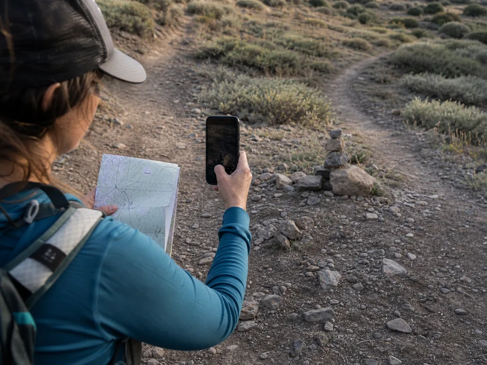
Do not delay an urgent navigation decision to make a perfect report. First return to known ground or deal with immediate weather, injury, and daylight limits. Send the information after you are safe and have a reliable connection.
Report what you saw, not a verdict. Staff can compare your location and photographs with their maintenance records, then repair, remove, or leave the structure according to local policy.
Sources
The National Park Service rock cairn guidance explains why cairn practices differ by park and why visitors should not alter them. El Malpais National Monument describes keeping the next cairn in sight on a cairned route. Olympic National Park warns that visitor or research markers in cross-country terrain may lead elsewhere. Leave No Trace explains why visitors should leave rocks and other natural objects where they are.
AnswersQuestions readers ask
What does a cairn mean on a trail?
It may be an approved route marker where a visible tread or painted blaze is difficult to maintain. Confirm that the park or trail system actually uses cairns before relying on one.
Should hikers build cairns?
No. Unauthorized cairns can mislead hikers and disturb soil, plants, habitats, or cultural features. Leave rocks and existing cairns unchanged.
Should I knock down a cairn that looks unofficial?
No. Record its location and report it to the land manager. A visitor may not know whether the cairn is maintained, historic, or culturally important.
How do I follow a cairned route?
Use the official map and route description, keep the next approved marker in sight, look back for the return view, and stop when the sequence no longer matches the terrain.